POTTER VALLEY PROJECT
Timeline
-
No Summer Water
Pre-1900s
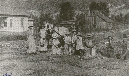
The Russian River and the Upper Main-Stem Eel River often dry up in the summer.Limited water means agriculture is limited to dry farming in the summer.
-
New Dams Supply Water & Power
People and farms proliferate.
Cape Horn Dam is build, creating Van Arsdale Reservoir.
-
Scott Dam is Built
Water through the summer.
Scott Dam is built creating Lake Pillsbury. Water flows into the Russian River through the summer.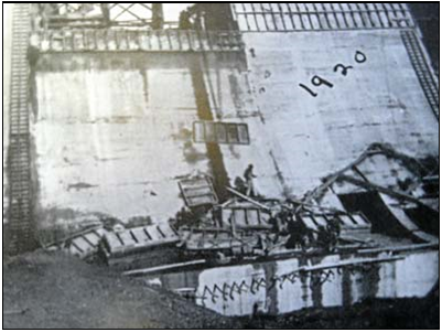
-
PG&E Purchases License for Potter Valley Project
1930s - 2019
-
Flood Wipes Out Ukiah Valley
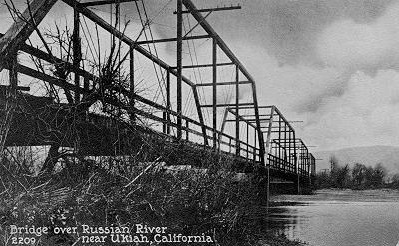
“The heaviest storm this county has ever known has cast with lavish abandon destruction and flood, wrecking man-made highways and railroads, lashing rivers into furies with torrents of rain—south of old Burke Ranch [south Ukiah valley] the Russian spreads from the highway across the valley to its eastern edge, one great expanse of muddy, turbulent water, a probable mile in width, dotted with the tops of trees, trash covered fences, surrounding ranch homes and barns. Damage to the highways, farmland, loss of cattle and sheep, cannot be estimated.”
– Ukiah Dispatch Democrat, December 17, 1937.
-
Another Devastating Flood
Helps garner public support for dams.
In 1955 on Christmas there was a terrible flood. Many people can clearly recall downtown Ukiah underwater.The Ukiah Daily Journal reported that “if Coyote Valley Dam had been in place it would have prevented over 2 million dollars in damage locally”.

-
Flood Project Phase 1
Coyote Valley Dam is built, creating Lake Mendocino.
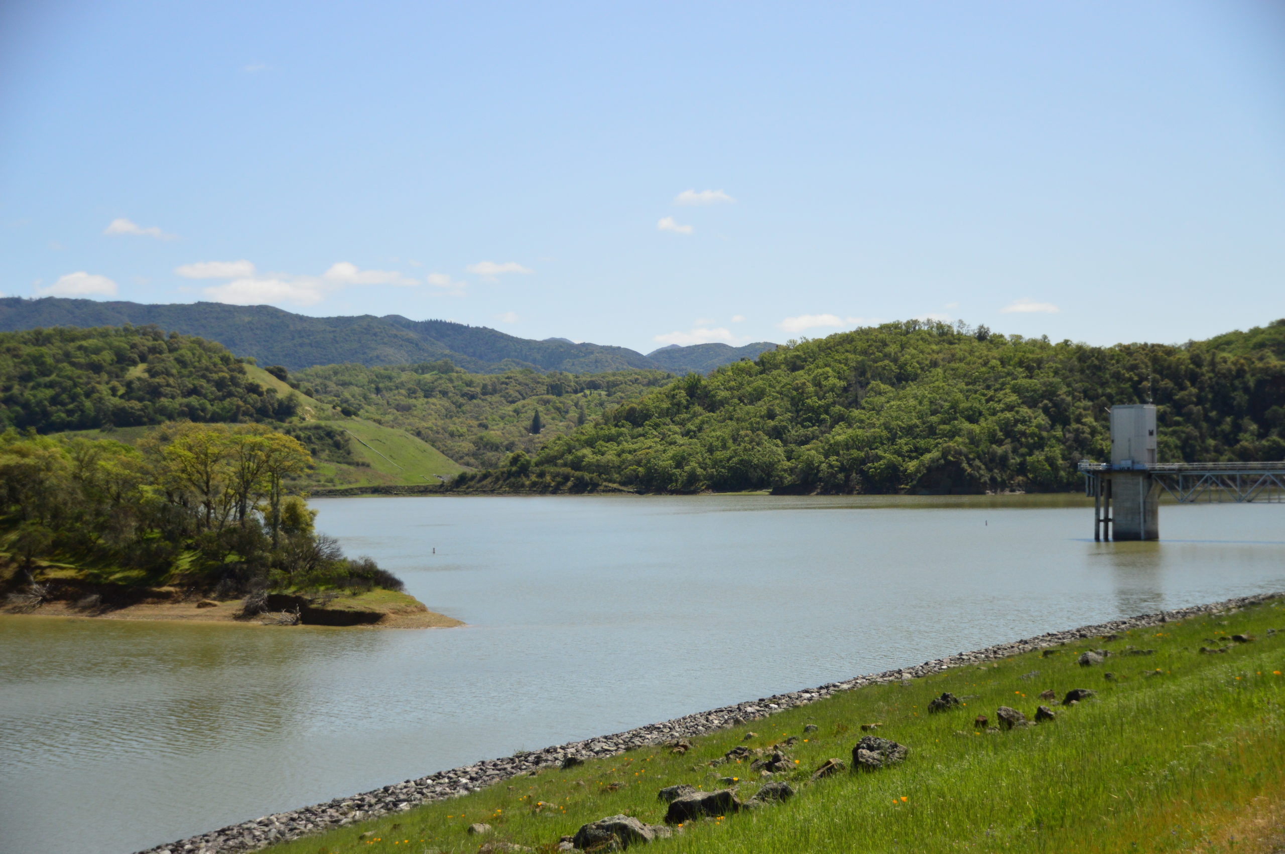
-
Intense Downpours Across Northern California Causes Flooding
We surmise that, because Coyote Valley Dam functioned very well in the 1964 flood of record, the need for raising the dam was deemed unnecessary.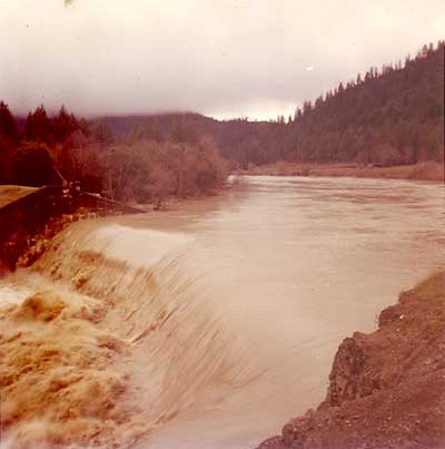
-
50-year License Runs Out
50-year license for the Potter Valley Project expires.
Project runs on a year-by-year basis until 1983.
-
Flood Project Phase 2
Warm Springs Dam is built, creating Lake Sonoma.
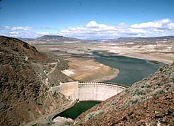
-
Flows Reduced by 50%
The diversion of water flow is reduced.
As a result of studies done since 1983, the diversion of water flow is reduced making Potter Valley Project uneconomical for hydropower production and reducing water supply.
-
PG&E Decides to Sell the Project
MCIWPC intends to bid.

-
PG&E Withdraws NOI to Relicense
The NOI Partners file a new Notice of Intent to license the project. -
Current License Expires
*Click the date to learn more about each event and the arrow on the right to go down the timeline.

![historic_penstock[1] historic_penstock[1]](https://mendoiwpc.com/wp-content/uploads/2019/11/historic_penstock1.jpg)

IN-DEPTH
History
The Russian River: Earliest Times
The river we know as the Russian has had many names. The Pomo called the river Ashokawna and simply, The River. Russian and Mexican explorers gave the river other names like Slavianka, San Ygnacio and Rio Russo. The Russian River has been its name on maps and in documents since the mid 1800’s, but, if you think of it, we commonly still refer to this meandering water course as “The River” in our everyday conversation.
The first evidence we have of people living along the river were left at village sites by the Yokaia’s from thousands of years ago. There were six main village sites, believed to have been used in different seasons, from near what is now known as Redwood Valley down to Hopland. We know the Yokaia caught fish in the river using basket traps, nets and spears. We also know that they had special collecting sites along the river where the soil was deep sandy loam and the willow roots grew straight and long–perfect for weaving their beautifully crafted and world-renowned baskets. From time before memory people have lived on the banks of the Russian River.
There are ancient stories of the river and her origin told from generation to generation. Some may truly be legends, most are probably based on truth. The Pomos have, what has been called, a legend that once the water from Clear Lake ran west through what is now Blue Lakes, through Cold Creek into Coyote Valley and the Russian River drainage. The legend continues to tell the story of a great upheaval in the land, a huge rockslide blocked the flow of water out of Clear Lake to the west. The land was suddenly forced up and the water from Clear Lake began to flow to the east, through what is now called Cache Creek, where it continues to flow today. It is interesting to note that the elevation of Clear Lake is 600 feet above the Ukiah Valley and not surprising to note that more recent geological investigations have shown that there have been tectonic events suggesting the legend is true!
By the 1840’s Mexican land grants had been awarded all along the Russian River. After the Bear Flag revolt in February 1848, California became part of the United States. First Nations People, Russian and Mexicans had all lived along the river before the first Americans from the east arrived. The first of these eastern American settlers in the Ukiah Valley was John Parker who arrived in 1851. It is estimated that, by nine years later, over 100 American pioneers had followed in Parker’s footsteps and settled in the valley. They grew hay and grain, raised cattle and sheep – initially all for local consumption. Roads were very poor, travel was difficult, but, in 1889 the Northern Pacific Railroad came to Ukiah.
The local economy changed dramatically. Now agriculture had a route to larger markets. Crops soon included hops, pears, apples, timber, grain, sheep, cattle and dairy products. By 1900 farmers had settled all along the Russian River. The reason people succeeded in farming here was the River. Very early on, farmers realized that the water was precious, and they began to secure new water rights from the State of California. In fact, if you go back a moment to the Mexican Land Grants, one can still find the earliest water rights attached to these grants on property deeds today. Water rights were the invention of the west where water has always been more precious than anything else.
The Russian River has changed over the millennia. Some of the changes are due to natural events such as floods. Other changes are manmade. It was at the turn of the 20th century that the first of two manmade water projects in the Russian River watershed came to be. These two projects have changed the face of the river, and the lives of people who have lived along its banks, ever since then.
History of the Russian River Water Supply: When Two Rivers Were Linked
The source of water for the Russian River is, like most of our northern California rivers, rainfall in the surrounding watershed from winter and spring storms. The summer finds most of our river systems, under natural conditions, hot and dry. It wasn’t until Scott Dam was built to store winter rainfall on the Upper Mainstem Eel River in 1922 that water began to flow in the summer. The Eel and the Russian rivers were first linked together by a tunnel dug through a hill in 1908. Their histories have been bound together for 110 years.
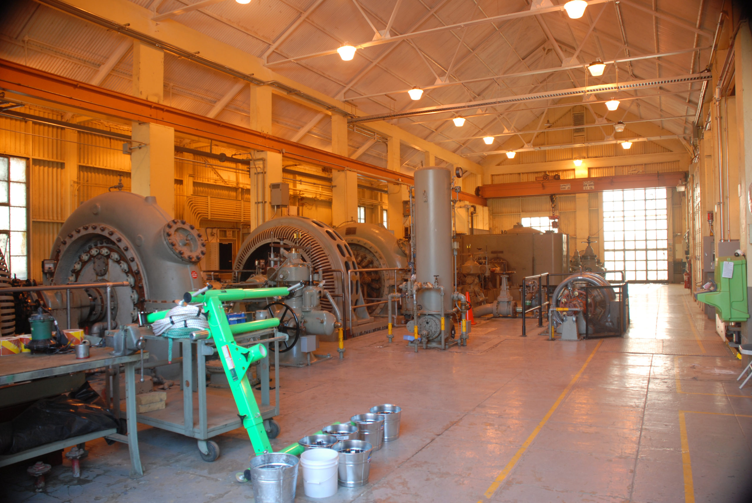
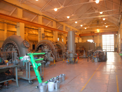
It is not easy for us today to understand what life was like in the early part of the 20th century. A world war, then a depression and another world war had made life difficult. At the same time entrepreneurs and innovators continued to try and make life better for people. Little did W.W. Van Arsdale envision that, by diverting water from the Upper Mainstem Eel River through a mile-long tunnel into a small hydro power plant in northern Potter Valley, how the communities along the Russian River would change. Van Arsdale’s sole purpose was to assure that the City of Ukiah would no longer be dependent upon a coal burning electrical power plant. In 1905 he built a small dam called Cape Horn, which backed up Van Arsdale Reservoir, and then a tunnel from the new reservoir transferred water from the Upper Mainstem Eel River through the northern hills of Potter Valley. The water exited the tunnel through the hills and fell over 475 feet through penstocks and into a small hydroelectric plant called the Potter Valley Powerhouse. When the project was completed in 1908 it could only produce power when the Upper Mainstem Eel River had flows high enough to be diverted into the tunnel Van Arsdale had excavated. Because the river only had natural flow during the rainy winters and early spring a summertime water supply was needed to produce power year round.
The only way to realize a summertime water source was to capture rainfall in the winter, store it and release it to run through the powerhouse during the dry late spring, summer and fall months. As we know, dam building projects in the early 1900’s in the western United States were not unusual. In the grand scheme of things a small dam on the Upper Mainstem Eel River was not considered to be a monumental task. So, Van Arsdale, with help from San Francisco investors, built Scott Dam forming Lake Pillsbury, twelve miles upstream of the Van Arsdale Reservoir. The dam was completed in 1922. Now the Potter Valley Project could store water in Lake Pillsbury in the winter and run its turbines year round. Remarkably, for all the people in Potter Valley and much farther south, surface water was suddenly flowing in the Russian River in the summertime!
The first beneficiaries of the new summer water were farmers. Until Scott Dam was built in 1922 Potter Valley and all of the agricultural areas south, except those areas immediately adjacent to the Russian River, were dry farmed through the summer. Dry farming severely limited both the type and production of crops. It also limited the number of head of livestock that could be raised. For agriculture, the availability of water has been, and still is, the key to success and the only way to maintain a competitive edge. With the Potter Valley Project water agriculture has flourished all along the Russian River corridor in Mendocino and Sonoma counties. The original benefits of the new water supply to agriculture quickly expanded as small communities grew and thrived all along the Russian River.
Today we also benefit from the hydroelectric power that is produced by the Potter Valley Project and the smaller power plants down river. In total they produce enough electricity to supply 2,000 homes with power.; however, now 110 years later, the benefits provided by the water supply have far exceeded the original purpose that W.W. Van Arsdale envisioned in 1905.
Coyote Valley Dam & Lake Mendocino
The second manmade project on the Russian River in Mendocino County was the result of a need for protection from floods. There have always been floods on California rivers. Floods are the reason our rivers travel where they are and look the way they do. Large winter storms are a normal part of our climate. Until the early 1900s little property damage was sustained in our area because there were few permanent structures. As homes, farms, bridges, roads and orchards were developed, loss to floods became substantial. The winter of 1922-27 was particularly bad—but it was the flood of December 1937 that finally caused people to despair. The following quote describes the devastation.
“The heaviest storm this county has ever known has cast with lavish abandon destruction and flood, wrecking man-made highways and railroads, lashing rivers into furies with torrents of rain—south of old Burke Ranch [south Ukiah valley] the Russian spreads from the highway across the valley to its eastern edge, one great expanse of muddy, turbulent water, a probable mile in width, dotted with the tops of trees, trash covered fences, surrounding ranch homes and barns. Damage to the highways, farmland, loss of cattle and sheep, cannot be estimated.” Ukiah Dispatch Democrat, December 17, 1937.
Immediate appeals were made for a government survey of the Russian river to look at flood control projects. In 1938 (one year!) Congress authorized the Army Corps of Engineers to study the flood control problem in Mendocino and Sonoma Counties. The Corps determined that a three phase project was needed. Phase one, build Coyote Valley Dam north of Ukiah, phase two was Warm Springs Dam in Sonoma County and phase three was to raise Coyote Valley Dam another 36 vertical feet. In 1949 the headlines of the Ukiah Republican Press said with regards to the anticipated completion of Coyote Valley Dam, “We will have enough water to supply all future demands, with surplus to export”.
The building of Coyote Valley Dam was controversial. There were 32 farms in Coyote Valley and most of the farmers were not happy about the loss of their land to eminent domain. The Mendocino County Farm Bureau opposed the dam for several reasons including the loss of part of the property tax base, cost of relocating roads, no provision for a fish ladder and subsequent loss of Steelhead Trout in Potter Valley and Cold Creek, and that the dam would not be sufficient in size to mitigate large storm events. Many people thought we didn’t need a dam because it was too expensive. Money was tight after the depression and the war and, because of short term memory loss, the flood problem was believed to be Sonoma County’s problem…not Mendocino County’s. There were others in Mendocino County who understood that whomever paid for the project would benefit from the water.
By 1955 there was still no dam, but Sonoma County voters stepped up and overwhelmingly approved two bonds for 14 million dollars to finance the project.
Then in 1955, as fate would have it, there was a terrible flood at Christmas. Many people clearly remember that downtown Ukiah was underwater. People were stranded on either side of the Russian River. The Ukiah Daily Journal reported that “if Coyote Valley Dam had been in place it would have prevented over 2 million dollars in damage locally”. In January 1956 Mendocino County voters, three to one, voted to pay $650,000 towards building the dam. The Mendocino County Flood Control and Water Conservation Improvement District was formed by the State of California to hold and retire the bond. Eventually Coyote Valley Dam was completed and filled to the first stage level in February 1959.
Mendocino County had paid for 11% of the stored water and was granted a water right permit for 8,000 acre feet of water. Sonoma County was allotted the balance of the water supply. Today the Army Corps of Engineers manages the lake for flood control depending upon the time of the year and lake level. Sonoma County Water Agency controls releases from the lake the rest of the year.
As part of the mitigation for building Coyote Valley Dam without fish passage a fish hatchery was built at the base. This is still functioning today.
Adding to the power generation produced by Eel River water that is diverted through the Potter Valley Project and the three small hydropower houses in Potter Valley, the City of Ukiah has a 3,500 kW hydropower plant below Coyote Valley Dam. Water diverted from the Eel River is being beneficially used over and over again providing a clean, renewable, source of electrical energy.
Today thousands of people camp, fish and boat at Lake Mendocino. In fact, Lake Mendocino is one of the U.S. Army Corps of Engineers most popular recreational sites, in terms of numbers of users, in the nation.
Lake Mendocino provides the water supply for hundreds of thousands of people, supports the economy of inland Mendocino, Sonoma and Marin counties, provides hydro electrical power, has a fish hatchery and provides recreational opportunities for many thousands of people. None of this would be possible without the diversion of water from the Eel River through the Potter Valley Project.
Who Uses the Potter Valley Project Water? Dependence, Quality of Life and Economy
From Potter Valley at the head of the East Branch of the Russian River to Jenner at the mouth, a percentage of the water you see flowing in the Russian River is from the Potter Valley Project’s diversion from the Eel River. Depending upon the time of the year, and the reach of the river, the diverted water from the Eel River is comingled with natural flows from the other small tributaries of the Russian River watershed. In the late spring, summer and fall, the majority of the water flowing in the Russian River above the confluence with Dry Creek, is water that has been stored from winter rains in Lake Pillsbury, diverted through the Potter Valley Project, stored again in Lake Mendocino and released to flow down the Russian River to the sea. Today, all along these 110 miles of river, people live, work, farm, fish and recreate. Their dependence on the river is profound. Nearly every aspect of their everyday lives is dependent upon water in the Russian River.
Mendocino County
In Mendocino County the communities of Potter Valley, Redwood Valley, Calpella, Millview, Ukiah Valley, Talmage and Hopland are dependent upon the Russian River. The drinking water supply for 30,000 people in Mendocino County comes from Lake Mendocino. Water for fire suppression and many commercial and industrial businesses comes from Lake Mendocino. Taking into account agricultural products, jobs and local tax revenue, in a recent study, Dr. Robert Eyler calculated that 740 million dollars of the business revenue of Mendocino County per annum is directly dependent upon irrigation water diverted from the Eel River through the Potter Valley Project and stored in Lake Mendocino.
Sonoma County & Marin County
The Russian River flows south from Mendocino County into Sonoma County just north of the town of Cloverdale. From here to the confluence with Dry Creek the towns of Cloverdale, Geyserville and northern Healdsburg are completely dependent upon summer flows in the Russian River; therefore, they are dependent upon water from the Potter Valley Project, stored in Lake Mendocino and released below Coyote Valley Dam! Alexander Valley, one of the premier wine grape growing regions in California, is dependent upon the Russian River for their irrigation water. In 2016, Alexander Valley produced 145 million dollars of wine grapes (this does not include a multiplier valuation). Sonoma County Water agency estimates that Alexander Valley uses 11,000 acre feet of water from the Russian River.
Water from the Potter Valley project diversion is important to the Russian River even below the confluence with Dry Creek. The Sonoma County Water Agency meets downstream demands and minimum instream flow requirements, required by their water rights, by balancing storage releases from both Lake Sonoma and Lake Mendocino. Potter Valley Project water is an important component of the water supply needed to meet the requirements of the Endangered Species Act Biological Opinion, the instream flow requirements for environmental and recreational use established by the California State Water Resources Control Board Decision 1610 and deliveries to cities and water districts in Sonoma and Marin Counties.
The Sonoma County Water Agency estimates that 600,000 people in Mendocino, Sonoma and Marin Counties are dependent upon water from the Potter Valley Project’s Eel River diversion for their domestic, agricultural and recreational water supplies. The California State Water Resources Control Board, in Decision 1030, describes the water diverted from the Eel River as having the “appearance of naturalness” and they have granted appropriative water rights to this water supply all along the Russian River ever since Scott Dam was built in 1922. And importantly, instream flow requirements, mandated under the Endangered Species Act for protection of migrating fish in the Russian River, are supported by the water diverted by the Potter Valley Project.
Lake County
Lake County also benefits from the Potter Valley Project. Lake Pillsbury is located in Lake County and the water supply for Lake Pillsbury originates from the Lake County watersheds of the Rice Fork, Eel River, Gravelly Valley and many small creeks with names like Bear Gulch, Smokehouse, Salt Spring, Salmon and Horsepasture. Access to Lake Pillsbury is via two roads that wind through the forests of Lake County and Mendocino County. There are many permanent homes in the watershed around Lake Pillsbury. Thousands of people come every year to camp at over 200 campsites located in the campgrounds where they enjoy fishing and boating. Lake Pillsbury Resort is a busy annual destination for families who enjoy the remote and beautiful lake. From Lake Pillsbury hikers and explorers can easily access the Mendocino National Forest and explore the diverse ecosystems of Mt. San Hedrin and Hull Mountain. Lake Pillsbury is an important and strategic source of water often used by Cal Fire and the United States Forest Service for wildfire suppression. The lake provides a safe haven for those who might have to flee a wildland firestorm. Wildlife, such as Bald Eagles, migrating water fowl, introduced elk, deer and many other species of animals thrive along the shores of Lake Pillsbury. The Federal Energy Regulatory Commission license for the Potter Valley Project requires PG&E to maintain water levels at Lake Pillsbury to assure boaters access for boat ramps during certain times of the year. Lake Pillsbury is important to the economy of Lake County providing property tax and recreational value that would be lost if Scott Dam were to be removed.
Alternative Water Supplies
In the 1950s Potter Valley Irrigation District (PVID) tried to find an alternative source of water because they were concerned with the cost of the water they bought under their contract with Pacific Gas & Electric and they did not want to be so dependent upon the Potter Valley Project. In 1954, PVID hired Willits Soil Conservation District (known today as the Mendocino County Resource Conservation District), to survey the valley and find locations for one or more storage reservoirs. The results of the study determined that there were six potential sites. However, none of these sites could store more than 3,700 acre feet of water and the reliability of sufficient runoff to fill these small reservoirs year to year was in doubt. The six small reservoirs would have potentially held 14,400 acre feet of water and cost, on the average, $81.00 per acre foot to build. That would have been $1,166,000.00 in 1954. The concept was abandoned.
Dr. Robert Curry, hired by the Friends of the Eel River stated in his report to FERC “In Support of the Friends of the Eel River Comments on the Draft Environmental Impact Statement for the Proposed Reoperation of FERC Project 77-110” (April 26, 1999) that Potter Valley should just use their ground water pool and there would be no need for the Potter Valley Project water. This is untrue; there are no significant ground water pools in Potter Valley. In 1985, Ralph Scott, a geologist with the California Department of Water Resources (CDWR), stated at the Eel Russian River Commission that Potter Valley has a fractured aquifer, (Also see CDWR Ground Water Bulletin #118). Potter Valley is described geologically as a “pull apart valley” which is formed by a fault. When this occurs no significant ground water pools can form because of the tectonically ruptured rock base.
The U.S. Army Corps of Engineers asked MCIWPC to provide them a report on alternative water supply sources that would equal both the cost of increasing the height of Coyote Valley Dam by 36 vertical feet and provide the same amount of firm yield of a new water supply. Over the years Mendocino County has explored other potential sources of water. The only ones that could provide the volume of water equal to a raise of Coyote Valley Dam were the Dos Rios Project, a proposal by Humboldt Bay Municipal Water District for a pipeline and the idea of a desalination plant in Fort Bragg on the coast. For many reasons, including environmental concerns, exorbitant costs and lack of reliability, all of these concepts were rejected.
Potter Valley Project Controversy
The story above about how the Potter Valley Project (Project) came to be and about W.W. Van Arsdale, the successful entrepreneur, does not include a discussion of how the Potter Valley Project Diversion has been perceived during its long history. This interbasin transfer of water from the Eel River into the Russian River has not been without controversy. However, since Snow Mountain Water and Power secured the first Federal Power Commission (now the Federal Energy Regulatory Commission or FERC) license to run the powerhouse back in 1922, there have been restrictions on operations that protect the riverine habitat of the Eel River. When the end of the first fifty year FERC license neared, many different environmental, Tribal and beneficial user groups began to voice their concerns. Those concerns were first addressed during the long process of the relicensing that began in 1972, and then continued during many years of license amendment proceedings, ending in 2006. We are now involved in the next relicensing of the Potter Valley Project and a very involved process is underway proposing studies that will result in a much clearer understanding of the impact of the Project on many public trust resources.
Even though there is a very rigorous process in place to protect the ecosystem of the Eel River providing strict oversight on how the Project’s flow releases are managed from Lake Pillsbury below Scott Dam, at the diversion through the Potter Valley Powerhouse and the releases below Cape Horn Dam on the Eel River, there are those who are simply opposed to its existence.
The most vocal of these anti-Potter-Valley-Project groups has been the Friends of the Eel River (FOER). Their version of history accuses the Potter Valley Project of being the sole destroyer of the entire Eel River’s once-thriving runs of salmon and steelhead. This simply isn’t the case. Although no one can make the claim that the Potter Valley Project has had no environmental impact, it has not single-handedly destroyed the salmon and steelhead populations in the entire Eel River watershed. FOER’s stated goal is to return the historical runs of salmon and steelhead by removing the Potter Valley Project from the Upper Mainstem of the Eel River. They claim that simply by removing Scott and Cape Horn Dams the Eel River will return to its pristine prehistoric condition. While they cursorily mention some, they do not focus their efforts on other, more widespread and very serious, past and current impacts to the Eel River such a commercial fishing, pikeminnow, logging, road building, cannabis cultivation, droughts and floods. FOER have grossly exaggerated the impact of the Potter Valley Project on the Eel River while ignoring the truth about the historical benefit of the diverted water for hundreds of thousands of people in, and the ecology of, the Russian River.
FOER never discuss the environmental value of water stored in Lake Pillsbury that has historically been used to augment natural flows when fish have been stranded in the lower Eel River during drought years, or the benefit of cold water released below Scott Dam which provides prime rearing habitat for juvenile steelhead in the summer and fall.
Over the last 46 years, since the first hydropower license for the Potter Valley Project expired, millions of dollars and countless hours of time have been spent by real scientists to study and adjust the flows at the Potter Valley Project in an attempt to make it as invisible to the environment as possible by mimicking the natural hydrograph. This effort is required under the FERC license and PG&E must comply with all of the license conditions that were established in 2004. Once PG&E had withdrawn their Notice of Intent to relicense the Project, a new licensing process was undertaken by the Two-Basin Partnership. The partnership prepared a Feasibility Study that, among many other goals, determined what options existed for the future of the Project and detailed a series of studies that would not only looked at the current impacts of the Project on the Eel River, but also determined what impacts potential changes in the existing Project would have had on those dependent upon the water supply. Unfortunately, the Partnership was not able to complete these studies before the FERC relicensing deadline of April 2022.
Impact of the Potter Valley Project to the Eel River
The Potter Valley Project has had an impact on the habitat of the Eel River. We know, for example, that just over 8%, or 349 square miles out of 3,971 of the total square miles in the Eel River watershed, was cut off from migrating salmon and steelhead when Scott Dam was completed in 1922 (based on watershed measurements from the United States Geological Survey (USGS)). The number of actual stream miles of prime spawning and rearing habitat lost has recently been modeled by Emily Cooper in her Master’s Thesis, (Cooper, E.J. 2017. An Estimation of Potential Salmonid Habitat Capacity in the Upper Mainstem Eel River, California. Master’s Thesis. Humboldt State University, California) and her numbers will be verified in extensive aquatic studies that are to be undertaken over the next few years during the Potter Valley Project’s relicensing.
Environmental advocacy groups have claimed that the Potter Valley Project diverts up to 90% of the flow of the entire Eel River. The fact is that less than 10% of the Eel River watershed is above the Potter Valley Project diversion point on the Upper Mainstem Eel River and, on average, only 21% of the flow from this tributary is diverted through the Potter Valley Project annually. If one looks at the entire Eel River you find that, on average per year, only 1.6% of the entire Eel River is diverted through the Potter Valley Project. How do we know this? The average total annual flow of the Eel River, measured at the USGS gage at Scotia, is over 5,000,000 acre feet. Prior to the FERC Final Order, the average diversion through the Potter Valley Project was 160,000 acre feet per year, or just under 4% of the total. Since the Final Order was put into place in 2006, the average diversion, for the past twelve years, through the Potter Valley Project, has been 45,000 to 60,000 acre feet. That is, on average, 1.6%, of the flow of the entire Eel River.
What Would Happen if Scott Dam Were Removed?
Scott Dam allows rainfall and snow melt in the winter and early spring to be stored in Lake Pillsbury. The stored water is released from Scott Dam in the summer and fall. A portion of the water released from storage is diverted into the Russian River. The rest of the water is released below Cape Horn Dam to mimic natural flows, and to maintain required instream flows, below the Potter Valley Project to the confluence with the Middle Fork of the Eel River at Dos Rios. As this water is released from Scott Dam in the summer and fall it provides a constant supply of water to what would naturally be a dry riverbed between Lake Pillsbury and Van Arsdale Reservoir. If Scott Dam were removed there would not be enough water flowing in the Upper Mainstem Eel River in the twelve miles between the dams for recreation like rafting and canoeing. Historically, because of the cold water released from the base of Scott Dam, the section of the river between the dams has supported one of the most productive summer juvenile steelhead rearing habitats in the state of California. That too would be lost. During the recent drought, Pacific Gas & Electric convened a group of representatives from Fishery Agencies, beneficial users, Tribes and others to form the Potter Valley Project Drought Working Group (PVDWG). This diverse group worked together to manage the seriously diminished water supply in Lake Pillsbury. One of the accomplishments of the PVDWG was to strategically release water stored behind Scott Dam in Lake Pillsbury to enhance flows to help migrating fish in the lower Eel River to survive. This option would no longer be available during the next drought if Scott Dam were to be removed.
If Scott Dam forming Lake Pillsbury were removed all of the campgrounds used by boaters and fishermen would be vacant. There wouldn’t be a lake for boating, or fishing. In the summer the dry, gravel, river bed would not even support a kayak. No water would be available for wildfire suppression. The habitat for Bald Eagles and elk would disappear. As part of the discussion about the value of the Potter Valley Project we need to understand the economic impact of the loss of the entire Lake Pillsbury community and all of the vacationers that use the lake every year.
If Scott Dam were to be removed the flows that currently are diverted through the Potter Valley Project in the summer and fall would cease to exist! Three out of five years Lake Mendocino would not fill. [Reference UCDavis study published by Sandoval, et.al.] The water supply for over half a million people along the Russian River in the Counties of Mendocino, Sonoma and Marin would be critically impacted.
History of the Potter Valley Project Hydropower License
The Potter Valley Project is owned by Pacific Gas and Electric Company (PG&E) and licensed by the Federal Energy Regulatory Commission (FERC). The original license expired in 1972 and the Potter Valley Project was relicensed for another fifty years to April 14, 2022. The first relicensing was an arduous and protracted process. For the first eleven years after the Potter Valley Project (Project) license expired in 1972 a year to year license was granted by the Federal Energy Regulatory Commission (FERC) until 1983. As part of a relicensing amendment process Pacific Gas and Electric (PG&E) was required to perform ten years of studies to ascertain how the flows from the Project might be modified to enhance conditions for migrating Chinook Salmon and Steelhead. A series of complex models were designed taking into account limitations on storage at Lake Pillsbury due to dam safety regulations, lake height for recreation, the contract obligation for Potter Valley Irrigation District, minimum instream flow requirements for the East Branch of the Russian River and for the Eel River below VanArsdale Reservoir. After these studies were completed, a group of fishery biologists, as well as other Federal Agencies, known as the Fisheries Review Group (FRG), met to discuss the findings and a final flow regime was agreed upon. Shortly after the FRG scientific consensus was reached the National Marine Fisheries Service (NMFS) initiated a Section 7 Consultation under the Endangered Species Act. A lengthy process commenced during which the NMFS found Jeopardy with the earlier generally accepted flow regimes for the Project and produced a Reasonable and Prudent Alternative (RPA). FERC accepted the RPA and the Project flows are currently based upon the NMFS RPA. As a result of the RPA the flows diverted through the Project have been reduced by approximately 50% instead of the anticipated 15% we had been led to believe would be the result of the NMFS RPA.
We have now entered into a very structured time line for the second relicensing of the Potter Valley Project. The current relicensing process began in the fall of 2016 when PG&E requested all interested parties to provide information for a Pre Application Document. In April 2017 PG&E filed their Notice of Intent to relicense. A precisely timed process began once the Notice of Intent was filed with FERC. Scoping Documents were produced by FERC in June, 2017. Public Scoping meetings were held. Proposed Study Plans were prepared by PG&E and discussed at numerous technical working group meetings during the fall and winter of 2017. A Revised Study Plan was filed by PG&E with FERC in January of 2018 and accepted by FERC with minor changes in February of 2018. The first year of studies began in the spring of 2018 and were scheduled to continue through December of 2019.
On May 18, 2018, PG&E unexpectantly announced their intent to start an auction process to sell the Potter Valley Project and related FERC license. PG&E was scheduled to continue on with the study plan approved earlier in the year as they moved forward with their internal auction process. The wildfires of the Mendocino Complex that hit in the summer of 2018 impacted much of the forested areas around Lake Pillsbury and prevented data collection and completion of certain study plans. Then on January 25, 2019, in another shocking announcement, PG&E completely withdrew from the FERC license application process and concurrently ended their internal auction process.
On March 1, 2019, FERC started a 120-day timeline (July 1) for interested parties to submit pre-filing documents to FERC to be considered for the re-licensing of the now orphaned project. On May 14, 2019, the Mendocino County Inland Water and Power Commission, Sonoma Water, and California Trout, Inc. moved forward with a planning agreement for the potential licensing of the Potter Valley Project. Humboldt County became the fourth signatory at a later date. On June 28th, the four partners submitted a Notice of Intent to the Federal Energy Regulatory Commission (FERC) to file an application for a new license for the Project. No other applications were filed with FERC as of the deadline and FERC accepted the proposal in August 2019. The Round Valley Indian Tribes were also added as a partner.
Through the Planning Agreement, the partners were to complete a Feasibility Study by April 14, 2020. The Feasibility Study included:
- A description of the Regional Entity that would be formed and apply for the new license
- A Project plan showing capital modifications, as well as operations and maintenance requirements, for the continued delivery of water and generation of hydroelectric power
- A fisheries restoration plan with measures to be implemented under the new license
- A proposed study plan detailing additional studies necessary to develop a new license application
- A financial plan, including the specific sources of initial funding and subsequent revenues to fund the licensing, capital improvements, and operations and maintenance of the Project under a new license.
FERC approved the Feasibility Study, and the partners continued to work toward submitting all of the licensing application requirements to FERC in order to have the project licensed by April 14, 2022 which was PG&E’s license expiration date. However, the Partners were unable to complete the studies within the short timeframe and FERC directed PG&E to file a surrender application for the document and start the decommissioning of the project infrastructure.
Feasibility Study to Raise Coyote Valley Dam at Lake Mendocino
Raising Coyote Valley Dam a vertical 36 feet was authorized by Congress in the 1950s as part of the original flood control project plan for Mendocino and Sonoma Counties. We surmise that, because Coyote Valley Dam functioned very well in the 1964 flood of record, the need for raising the dam was deemed unnecessary. The drought of 1976-1977 made it clear that water supply was an extremely important benefit of Lake Mendocino and that the lake had insufficient storage capacity for the water supply needed along the Russian River in Mendocino County. Since the 1976-77 drought we have had two more very serious drought events, in 2008-2009 and again in 2012-2015, when Lake Mendocino was in imminent threat of being completely dry. These sobering events reinforced our concern that Lake Mendocino can only hold enough water to supply one year of our current water demand even with 50% mandatory water conservation mandates in place. Lake Mendocino, at its current capacity, cannot reliably provide water for our communities during multiyear droughts.
Even before the more recent droughts, back in 2004, the Mendocino County Inland Water and Power Commission asked the U.S. Army Corps of Engineers to look into the concept of raising Coyote Valley Dam. After a reconnaissance study in 2005 they agreed that moving into a Feasibility Study to raise Coyote Valley Dam was warranted. When the dam was built many of the issues associated with a dam raise were factored into the process including the elevation of the bridge on Highway 20, procurement of easements around the lake, placement of camp grounds and the engineering of the structure of the dam to support the new height. The Feasibility Study process has been slowed by a lack of Federal Funding, regulations and prioritization, but we are hopeful that we can realize a project in the near future. We know that the water stored in Lake Mendocino provides multiple benefits to the Russian River watershed and that raising Coyote Valley Dam to the original Congressionally authorized height would be one more very important step in securing our critically important water supply.
In 2021, IWPC was notified that the Corps of Engineers might once again be funded in upcoming Congressional allocations to proceed with the Coyote Dam Feasibility Study. IWPC has sent the Corps a Letter of Intent and efforts are underway to secure Federal funding. Congressman Huffman is helping to facilitate these efforts.
Shared Water Resources. How Do We Continue to Beneficially Use the Water and Protect the Environment?
The Eel River is a vast watershed within the Counties of Humboldt, Trinity, Tehama, Glenn, Colusa, Lake and Mendocino. The Counties of Mendocino, Sonoma and Marin benefit from the water diverted from the Potter Valley Project. The Upper Mainstem Eel River above Van Arsdale Reservoir originates in Lake County and flows through Mendocino County. Mendocino County is the only one of these counties to have both the Russian and Eel River within its boundaries and we are very concerned about all aspects of the health of both of these unique, and precious rivers. All of the above mentioned Counties benefit in some way from the Eel River. The Eel River’s ecological diversity and beauty is unsurpassed. The value of the water diverted into the East Branch of the Russian river supports the ecology of the Russian River below Coyote Valley Dam, a thriving economy in three counties and a quality of life that cannot be replaced.
The beneficial use of water diverted from the Upper Mainstem Eel River has been in place so long that the California State Water Resources Control Board describes it, in their Decision 1030, as having “the appearance of naturalness”. Does this alone justify the diversion? Perhaps not, however the argument that if the Potter Valley Project were to be removed from the Eel River watershed that would, in and of itself, “fix” the Eel River fishery and restore it to its former glory and abundance is also not an honest argument for removal. Removing the Potter Valley Project will not “uncan” the millions of fish that were caught in the 1800s. Removing the Potter Valley Project will not minimize the impacts of past droughts and floods, or of logging, recreational fishing, cannabis cultivation and decadal oscillations in the complex ocean currents of the Northern Pacific Ocean.
Evolution is not solely owned by every other species but humans and genetic evolution is not the only kind! Humans have gone through behavioral and cultural evolutions. At one time we imagined, calculated, constructed and produced many things that benefited humankind, made our lives better, secured clean supplies of water, produced abundant food, improved our quality of life and harmed the environment. Now we need to spend our efforts imagining, calculating, constructing and producing ways to preserve the benefits we depend upon and at the same time mitigate those early impacts. We are more than capable of doing this. We can wisely use our shared natural resources and protect and improve conditions for our critically important ecosystems. We often use the term “quality of life”. This means something different to each of us. On one hand it might mean health, safety, comfort and economic success. On the other hand it might mean protection of our unique ecosystems and amazing natural diversity. Is there some reason that we cannot manage to have both? As far as we have come as humans in our ability to understand the impacts of our actions we must be able to sustain the quality of life we enjoy and protect the natural world around us at the same time. The only way this can happen is if there is a willingness by all who share the diverse resources of the Eel River to work together. This will not be simple or easy, but it is necessary!
In 2010, MCIWPC asked Humboldt County to consider working together and building an alliance dedicated to protecting our shared Eel River resources from interests outside of our region. The letter can be seen here. The request remains in place and we are hopeful that one day we can stand side by side with all of the Counties that benefit, in one way or another, from the beauty and vastness of the Eel River.

